Politics
7 min read
Blizzard Warning Continues: Prepare for Difficult Travel Sunday
PembinaValleyOnline
January 18, 2026•4 days ago
AI-Generated SummaryAuto-generated
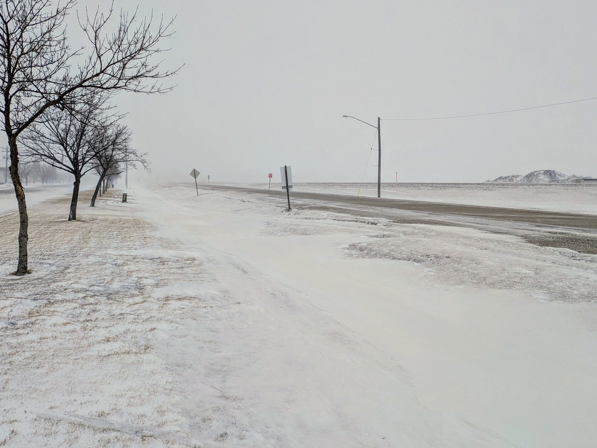
A Blizzard Warning remains in effect for the Red River Valley, predicting very difficult travel conditions throughout Sunday. Strong northwesterly winds with gusts up to 80 km/h, combined with light snow and existing accumulations, will cause substantially reduced visibility and potential white-out conditions. Arctic air will also bring below-average temperatures.
Very difficult travel conditions are expected Sunday as a Blizzard Warning continues for the Red River Valley including the Morden/Winkler, Carman, Altona, Emerson, Morris, Dominion City, Steinbach and Vita. A Blowing Snow Advisory is in effect for regions that border the warning area.
Sun Valley Tire Road Report & Cancellations
"Light snow began Saturday night from the latest Alberta clipper to make its way here, and we're expecting periods of light snow throughout a portion of Sunday," explained CMOS Accredited Weathercaster Chris Sumner. "A strong Arctic cold front is sweeping through the province today, and combined with the snow that's fallen and the flakes expected to come, extended periods of substantially reduced visibility in blowing snow are likely for a large portion of the day."
Sumner noted 2 to 5cms of fresh snowfall from this latest Alberta clipper is what we can expect accumulation wise, but due to it being quite light in weight, just like Thursday and Friday's system, it will be very easy to blow around leading to white-out and near-zero visibility in the Red River Valley, and only marginally better in regions bordering it.
"The winds shifted from southerly overnight to northwesterly early Sunday morning, and will increase quickly with those 80km/h gusts possible before noon, and then continuing for the afternoon," he said. "The winds will diminish Sunday evening, but we can expect challenging travel conditions for a large part of the day before that happens and conditions improve tonight. It is likely we will, again, see some highway closures in Southern Manitoba."
CDK Electric 5-day forecast
Behind the cold front is a chilly Arctic air-mass that will drop temperatures throughout the day, landing around -21 degrees Sunday afternoon. Averages for this point in January are -12 degrees daytime and -23 degrees overnight.
Sumner noted we're looking at temperatures slightly below average for most of the week, in the -14 to -17 range, before a bitterly cold air-mass is expected to arrive to end the week and start the weekend.
"At this point, the long-range forecast models are suggesting this could be the coldest stretch of winter weather so far, with multiple consecutive days when overnight lows are dip into the -30s and daytime highs struggle into the -20s."
Rate this article
Login to rate this article
Comments
Please login to comment
No comments yet. Be the first to comment!