Space & Astronomy
19 min read
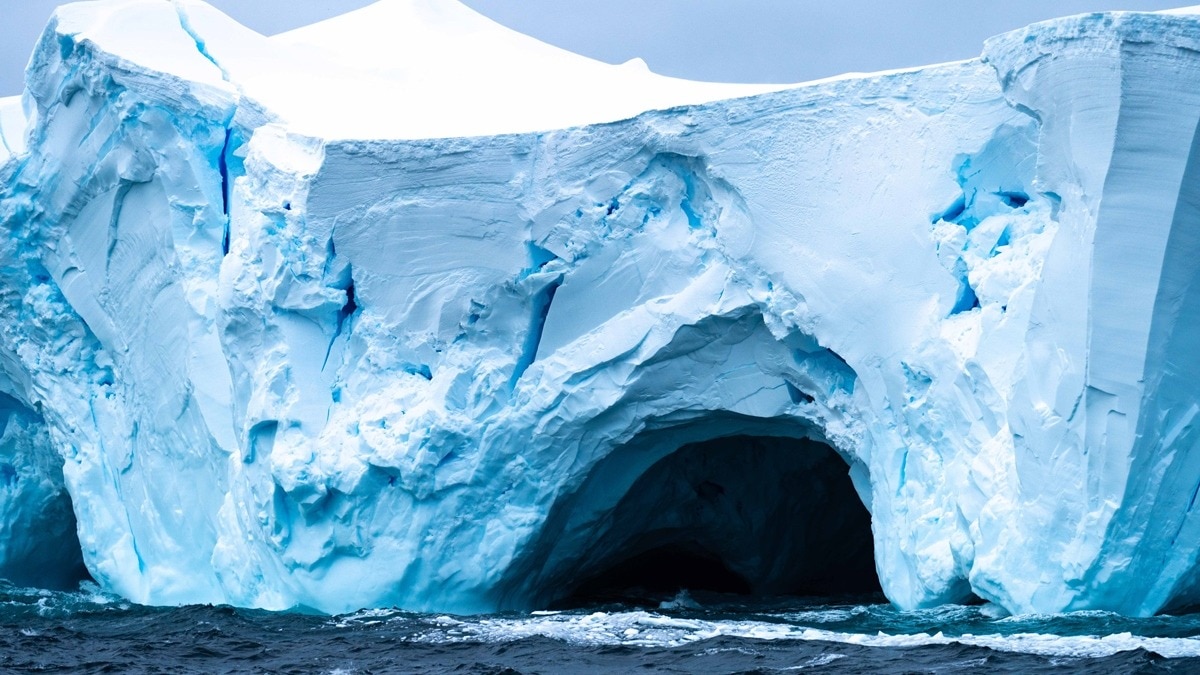
Explore Antarctica's Uncharted Terrain: A New Map of Giant Mountains Revealed
India Today
January 19, 2026•3 days ago
AI-Generated SummaryAuto-generated
Scientists have created the most comprehensive map of Antarctica's subglacial terrain, revealing vast mountains, canyons, and over 30,000 uncharted hills. This new map, generated using satellite data and ice-flow analysis, provides unprecedented detail of the hidden landscape. The findings are crucial for improving models that predict ice sheet behavior and its contribution to global sea-level rise.
Scientists have produced the most comprehensive map yet of the terrain beneath Antarctica's massive ice cover, revealing a dynamic landscape of mountains, canyons, valleys, and more than 30,000 previously uncharted hills.
The team combined high-resolution satellite observations with a technique called ice-flow perturbation analysis, which uses surface features to estimate the underlying topography. This enabled them to map the entire continent, including areas previously uncharted.
advertisement
Better knowledge of the subglacial bedrock could help scientists forecast how Antarctica's ice sheet will respond to climate change.
Rugged features like hills and mountains can slow ice retreat. "Having the most accurate map of Antarctica's bed shape is crucial, because the shape of the bed is an important control on friction acting against ice flow, which in turn we need to include in numerical models that are used to project how rapidly Antarctica's ice will flow towards the ocean, melt and contribute to global sea-level rise," said glaciologist Robert Bingham of the University of Edinburgh, who helped lead the study published in Science.
advertisement
The map identifies over 30,000 hills at least 165 feet (50 meters) high. Antarctica, about 40% larger than Europe and holding 70% of the planet's freshwater, features a subglacial landscape as diverse as other continents.
"In every case, all of these continents contain an array of very different landscapes in themselves, from towering mountain ranges to immense flat plains. The hidden landscape of Antarctica also contains these vast extremes," Bingham said. "Boring it is not."
Some of the most striking features include dissected plateaus and deep-carved glacier valleys, resembling landscapes in Scandinavia, northern Canada, and Greenland. "Possibly the type of landscape that many people might know less is 'plateaus dissected by deep-carved glacier valleys.' In fact, the very fact that the landscape our technique has uncovered across Antarctica matches these landscapes so well gives us great confidence in our new map," Bingham said.
Traditional mapping methods relied on radar data collected by aircraft or snowmobiles, often leaving significant gaps. "But these surveys often have gaps of 5 km (3.1 miles) or 10 km (6.2 miles) between them, and sometimes up to 150 km (93 miles)," Ockenden said.
advertisement
The new technique, according to lead author Helen Ockenden, uses mathematical modelling of ice flow and satellite data to fill those gaps.
"It allows us to combine the mathematics of how the ice flows with high-resolution satellite observations of the ice surface, and say what the landscape beneath the ice must look like everywhere across the whole continent, including in all those survey gaps. So we really gain a much more complete idea of how all the landscape features connect together."
The research team believes this map will help improve models that project sea-level rise and guide future field surveys.
- Ends
Published By:
Sibu Kumar Tripathi
Published On:
Jan 19, 2026
Trending Reel
Scientists have produced the most comprehensive map yet of the terrain beneath Antarctica's massive ice cover, revealing a dynamic landscape of mountains, canyons, valleys, and more than 30,000 previously uncharted hills.
The team combined high-resolution satellite observations with a technique called ice-flow perturbation analysis, which uses surface features to estimate the underlying topography. This enabled them to map the entire continent, including areas previously uncharted.
Better knowledge of the subglacial bedrock could help scientists forecast how Antarctica's ice sheet will respond to climate change.
Rugged features like hills and mountains can slow ice retreat. "Having the most accurate map of Antarctica's bed shape is crucial, because the shape of the bed is an important control on friction acting against ice flow, which in turn we need to include in numerical models that are used to project how rapidly Antarctica's ice will flow towards the ocean, melt and contribute to global sea-level rise," said glaciologist Robert Bingham of the University of Edinburgh, who helped lead the study published in Science.
The map identifies over 30,000 hills at least 165 feet (50 meters) high. Antarctica, about 40% larger than Europe and holding 70% of the planet's freshwater, features a subglacial landscape as diverse as other continents.
"In every case, all of these continents contain an array of very different landscapes in themselves, from towering mountain ranges to immense flat plains. The hidden landscape of Antarctica also contains these vast extremes," Bingham said. "Boring it is not."
Some of the most striking features include dissected plateaus and deep-carved glacier valleys, resembling landscapes in Scandinavia, northern Canada, and Greenland. "Possibly the type of landscape that many people might know less is 'plateaus dissected by deep-carved glacier valleys.' In fact, the very fact that the landscape our technique has uncovered across Antarctica matches these landscapes so well gives us great confidence in our new map," Bingham said.
Traditional mapping methods relied on radar data collected by aircraft or snowmobiles, often leaving significant gaps. "But these surveys often have gaps of 5 km (3.1 miles) or 10 km (6.2 miles) between them, and sometimes up to 150 km (93 miles)," Ockenden said.
The new technique, according to lead author Helen Ockenden, uses mathematical modelling of ice flow and satellite data to fill those gaps.
"It allows us to combine the mathematics of how the ice flows with high-resolution satellite observations of the ice surface, and say what the landscape beneath the ice must look like everywhere across the whole continent, including in all those survey gaps. So we really gain a much more complete idea of how all the landscape features connect together."
The research team believes this map will help improve models that project sea-level rise and guide future field surveys.
- Ends
Published By:
Sibu Kumar Tripathi
Published On:
Jan 19, 2026
Trending Reel
Rate this article
Login to rate this article
Comments
Please login to comment
No comments yet. Be the first to comment!